top of page

WHATSAPP US ON +27 (0) 64 543 8653

MEDIA LIBRARY
Search


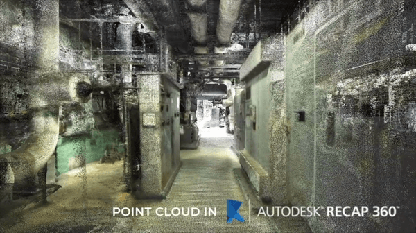
Unlocking the Power of Lidar Scanning for CGI: A Game-Changer in Digital Imagery
Photo credit: Business Insider In the realm of computer-generated imagery (CGI), technological advancements continually push the...
Oct 9, 20232 min read
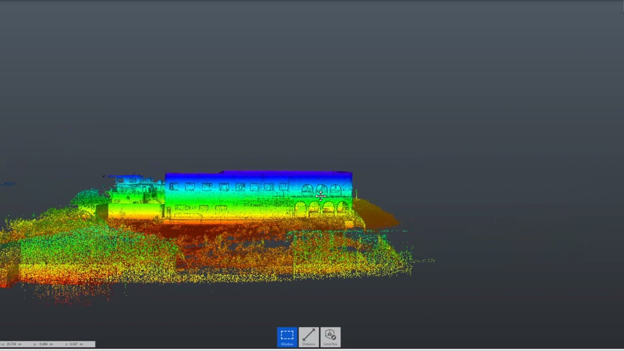
Unveiling the Architectural Wonders through Lidar Scanning
In the realm of architecture, the need to capture precise measurements and create accurate representations of structures is paramount....
Aug 18, 20232 min read


The Fast-Paced Digital World of 3D Marketing
In today's fast-paced digital world, marketing has become an essential aspect of any business. With the advent of technology, traditional...
Aug 14, 20233 min read

Breaking Barriers: The Importance of Bringing Physical Products into the 3D Digital Space
The advancements in technology have revolutionized the way we interact with the world around us, especially when it comes to shopping and...
Aug 14, 20233 min read


Introducing the BLK Reality Capture Series
This series offers a wide range of reality capture solutions for documenting as-built environments with both tripod, handheld and fixed...
Feb 8, 20211 min read


GIS Mapping Solutions for Agricultural Applications
Terrestrial Lidar Scanners are widely used in many areas and, in recent years, that includes agricultural tasks. With the development of...
Nov 9, 20202 min read


Covid-19 & Lockdown: How it is affecting the Construction Sector and how to stay ahead of the game.
According to the results of a survey conducted by Construction Computer Software (CCS) amongst its clients, stakeholders and industry...
May 27, 20204 min read


Archi-Tech & Geo-Plus partner to bring world leading AEC technology to the South African market
We are excited to announce that Archi-Tech has partnered with Geo-Plus to bring new and exciting software solutions for land and...
Apr 21, 20202 min read
How to save hours on designs and floor plans while saving money and improving workflows
Want to improve your workflow while saving time & money? Here's how... By using our service, we can provide you with accurate, real-time...
Apr 8, 20201 min read


3 BIG BENEFITS OF USING HANDHELD LIDAR
Handheld Lidar scanners will never replace the trusted tripod scanners, but depending on the industry you are in and the use case in...
Apr 6, 20202 min read
bottom of page